
Davenport ZIP Codes and Last Lines
USPS and Iowa public materials associate Davenport with 52801 through 52809. The Postal Service label list groups several numbers under the same preferred last line. Those groupings describe mail handling. They do not supply official street-by-street polygons, municipal borders, or lists of people.
| ZIP | Working area cue | USPS last-line group | Research note |
|---|---|---|---|
| 52801 | Downtown and central postal identity | Davenport 52801 | Direct group |
| 52802 | Central and river corridor | Davenport 52801 | Main Post Office uses 52802-9998 |
| 52803 | East and northeast | Davenport 52801 | Verify each address |
| 52804 | West and southwest | Davenport 52801 | Historic transition affects some deliveries |
| 52805 | Possible special or limited use | Davenport 52801 | Exact current service type not confirmed |
| 52806 | Northwest and west | Davenport 52806 | Direct group |
| 52807 | North and east fringe | Davenport 52806 | 2008 change is a historic clue |
| 52808 | Possible special or limited use | Davenport 52801 | Exact current service type not confirmed |
| 52809 | Possible special or limited use | Davenport 52806 | Exact current service type not confirmed |
The area cues are orientation only. They must not be turned into legal neighborhoods or city boundaries. Use the address-level result when the exact postal assignment matters.
Search Davenport Addresses With USPS
The Postal Service lookup offers three useful modes. “By Address” standardizes a full mailing address. “By City and State” finds ZIP options tied to a place name. “Cities by ZIP” returns city names associated with a number. None of these confirms that a named person or firm actually occupies a site.
| Field or mode | Input type | Required | Use |
|---|---|---|---|
| Company | Text | No | Optional mail-name detail |
| Street Address | Text | Yes | Primary delivery line |
| Apt/Suite/Other | Text | No | Unit detail |
| City | Text | Yes | Place name submitted with address |
| State | Selection | Yes | Iowa for a Davenport address |
| ZIP Code | Text | No | Optional refinement |
| Cities by ZIP | ZIP input | Yes | Returns associated city names |
USPS explains the basic role of these numbers on its ZIP Code basics page.
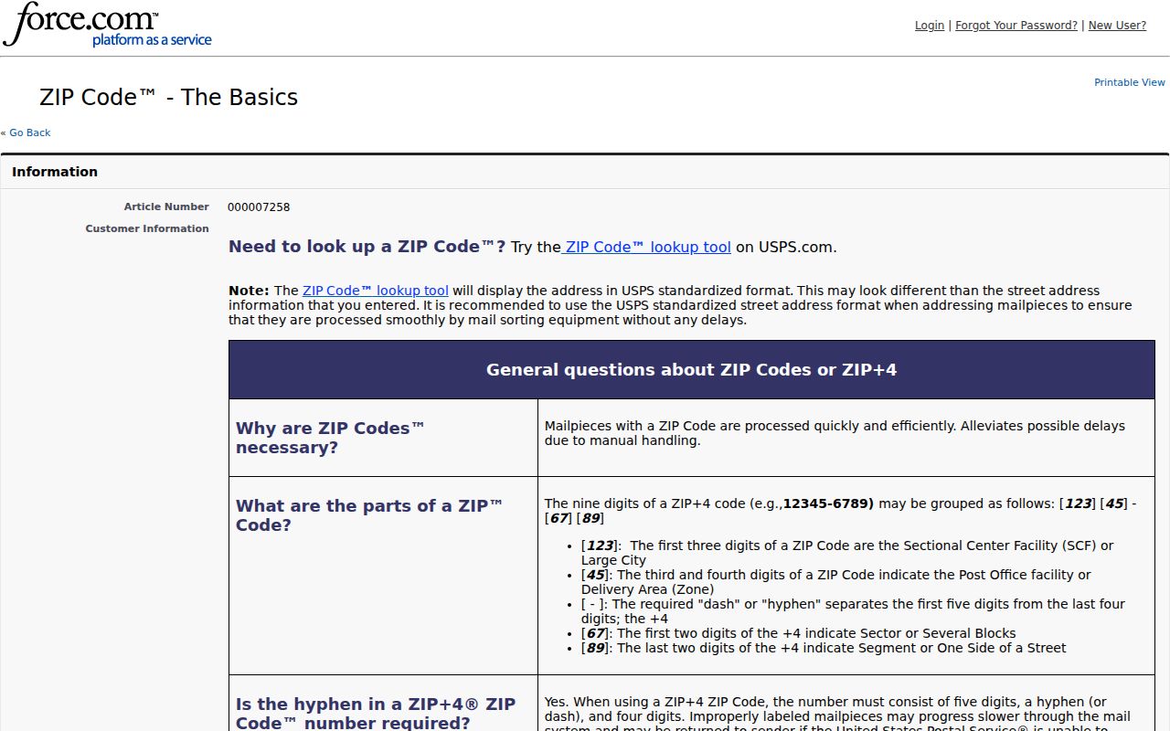
The captured explanation reinforces a key limit: a postal code routes mail efficiently but does not define a neighborhood, ward, or resident roster.
Find Davenport Residents by ZIP
A ZIP narrows geography, but a complete address or verified name still does the real work. Choose the next official system based on the record needed rather than entering a number into every portal.
- Enter the full street address in USPS lookup and save the standardized city, ZIP, and ZIP+4 result.
- Compare the address in the Davenport geocoder or Scott County GIS if the municipal location or parcel is unclear.
- Use a ZIP-capable official portal only for its stated record type, such as voter registration, a public license, or a recorded document.
- Read the result's date, owner or party role, mailing address, and source limits before linking it to a person.
- Confirm the finding with a second relevant record or contact the listed public office.
Once a ZIP search has narrowed the area to a named road, the Davenport street directory supplies the street-level workflow. Keeping those two stages separate avoids treating postal geography as parcel proof.
Davenport Portals With ZIP Data
Several government systems accept or return a postal code, but each answers a different question. A common field does not make their records interchangeable.
| Official portal | ZIP role | What the result means |
|---|---|---|
| USPS Lookup | Address input, refinement, and city/ZIP modes | Postal normalization, not occupancy |
| Iowa voter lookup | ZIP with house number and birth fields | Current registration response under portal rules |
| Davenport ArcGIS geocoder | Postal and PostalExt output | Normalized or mapped address candidate |
| Iowa public registry | ZIP in basic search | Registry record subject to terms and approximate mapping |
| Iowa MNLR | City and postal property-address fields | Lien-notice search, not a title or resident list |
| Iowa license portal | ZIP in license search | Public professional-license address field |
| Scott County AVA | Parcel/address mode includes ZIP | Recorded-document index in legal or party context |
| Beacon | Address search is documented | Parcel context; exact ZIP control was not confirmed |
No public ZIP-wide list of Davenport households was located. A portal returns matches within the record set it maintains, not every person who receives mail in that area.
Davenport ZIPs Versus City Limits
Davenport is the Scott County seat, incorporated in 1836. The official city overview describes roughly 66 square miles and eight wards. Yet postal service areas, city borders, election precincts, neighborhood labels, and parcel maps have separate purposes. One address can carry a Davenport mailing line while appearing differently on another geographic layer.
The city's annexation map includes expansion years from 1836 through 2002. That history matters when an older directory or plat uses a township, rural route, or different place name. Scott County also has rivers on three sides, and the Mississippi and Quad Cities setting encourages regional labels that may cross modern municipal or state lines.
- ZIP Code
- A five-digit Postal Service code used to route mail.
- ZIP+4
- The five-digit code plus four digits that narrow a delivery segment.
- PO-box ZIP
- A postal assignment used for box delivery rather than a mapped household area.
- Unique ZIP
- A code assigned to one large recipient or special mail operation.
- Carrier route
- A delivery path used by postal operations, not a city boundary.
Davenport's 52807 Postal Shift
A 2008 USPS Postal Bulletin records a specific local change. It says Davenport 52807 became the last line for 204 deliveries that had previously used 52804, while a Northwest Main Post Office used 52806. This is a useful historical clue when two documents give different ZIPs for what appears to be the same address.
Read the 2008 Postal Bulletin notice in its postal context.
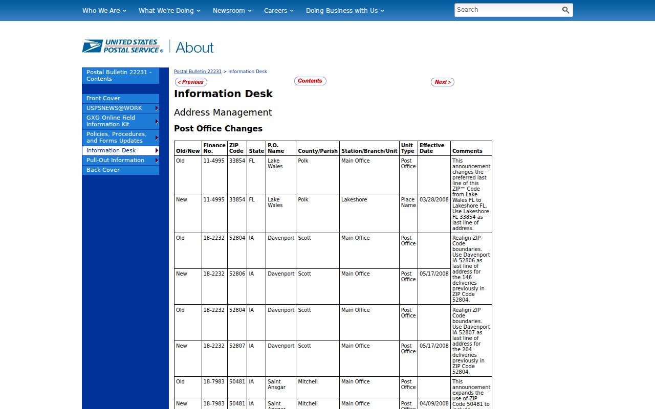
The notice documents a delivery change, not today's full boundary. Preserve the date and verify any current address through the live lookup.
Davenport Post Office Contact Routes
The Main Post Office is listed at 933 West 2nd Street, Davenport, IA 52802-9998, with phone 563-323-0306. A Northwest postal location is listed at 4018 Marquette Street, Davenport, IA 52806-9715. These public channels help when an address-level online result is unclear.
Check the Davenport post office location page before visiting.
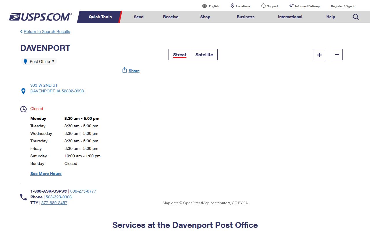
The office listing provides a direct contact route. Ask about postal addressing, not parcel ownership or city jurisdiction, which belong with the county or city map offices.
Geocode a Davenport ZIP Address
The Davenport ArcGIS locator returns Postal and PostalExt along with address candidates. It can help compare a mailing line with city map layers, but match settings matter. A loose result may be a street or locality candidate rather than a rooftop match. Save the matched address, score or match type when shown, and the date searched.
Scott County GIS, the Auditor's parcel-maintenance work, the Assessor, and Davenport Planning/Development and Neighborhood Services are the verified public contacts for address and geography questions. No separate public E911 address-assignment office or citywide address manual was confirmed. For a new or disputed situs address, ask the city or county map staff rather than guessing from the ZIP.
Match Historic Davenport ZIP Clues
No official citywide street-renumbering date was found. When an old city directory address does not fit a modern ZIP code directory result, keep the printed address intact. Compare the original street spelling, intersection, plat or lot, Sanborn map, and legal description.
Historic routes include the 2008 Postal Bulletin, Davenport city directories, Sanborn sheets, city maps, the annexation plan, and library house-history material. The county recorder requires a complete legal description for recorded land documents. That description, rather than a modern mailing label, is the bridge to title records.
Parcel identifiers also need care. Public permit examples include L0011-16A and L0007-24, but county pages do not publish a component-by-component key. Do not decode those strings into ownership, lot, or block facts without the county record.
Limits of a Davenport ZIP Search
A Beacon mailing address is not proof of every person at a parcel. A USPS result is not proof that a named person uses the address. A voter response follows its own eligibility and privacy rules. Protected records and confidential addresses may not appear in public output at all.
Online channels include USPS lookup, the label list, city geocoder, county GIS, and record-specific state portals. Phone and counter alternatives include the local post office, GIS or Assessor, Auditor Plat Room, and city Planning or Neighborhood Services. For past addresses, turn to directories, maps, plats, and library staff. State the search date and source limits when no match appears.